First step for using GPS
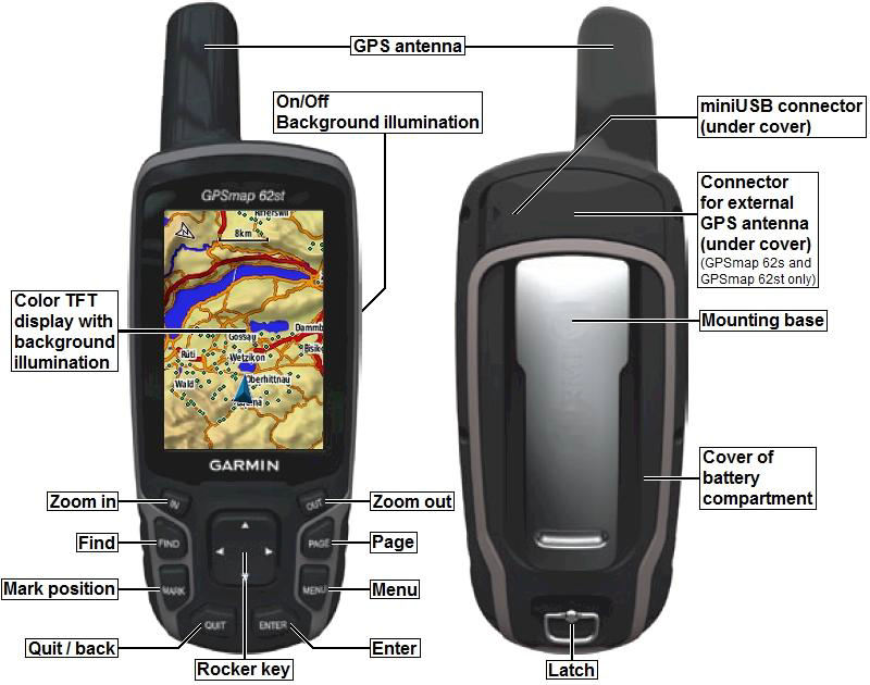
Installing the Batteries
1. Remove the bsttery cover by turning the D-ring 1/4 turn counterclockwise and pulling up.
2. Insert the batteries, observing polarity.
3. Replace the battery cover
Long-Term Storage
When you do not plan to use the device for several months, remove the batteries. Stored data is not lost when batteries are removed
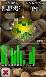
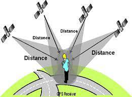
Check the Signal
1. Press page button to Main menu
2. Go to Satellite menu
3. Press enter button
4. Wait until GPS accuracy less than 10 meter. (in the upper right corner)
Check the Projection and Units
Check only once time.
1. Press page button to Main menu
2. Go to Setup menu
3. Go to Position Format menu checking
4. Select
Position Format: UTM UPS
Map Datum: WGS84
5. Go to Units menu checking
6. Select
Set the unit as meters or metric
7. Go to Time menu checking
8. Select
Time zone: Bangkok
Projection : UTM
Datum : VN2000
Zone : 47N & 48N
MARK WAYPOINT
Waypoints
Waypoints are locations you record and store in the device.
Creating Waypoibts
1. From any page, press MARK.
2. Select Done.
Navigating to a Waypoint Using the Search Menu
Yon can use the search menu to quickly find waypoints, track, routes, and coordinates thart you have saved.
1. From any page, press Find.
2. Select Waypoint.
3. Select waypoint.
4. Select Go.
Editing a Waypoint
Before you can edit a waypoint, you must create a waypoint.
1. From the main menu, select Waypoint Manager.
2. Select a waypoint.
3. Select an attribute (such as the name or location).
4. Enter the new information
5. Select Done.
Deleting a Waypoint
1. From the main menu, select Waypoint Manager.
2. Select a waypoint.
3. Press MENU.
4. Select Delete.
Using Sight ‘N Go
You can point the device at an object in the distance, such as a lighthouse, lock in the direction, and then navigate to the object.
1. From the main menu, select Sight ‘N Go.
2. Point the device at an object.
3. Select Lock Direction > Set Course.
4. Use the compass to navigate to the object.